


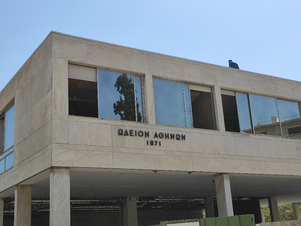
We will descend Rigillis Street and in approximately 200 metres we will find the Athens Conservatoire on our left. We will use the ramp for the cars at its entrance to access the pavement. We will use the street – that has relatively light traffic – with caution, until the Presidential Mansion.
We continue to descend Rigillis Street until the junction with Vasileos Georgiou B Street. There we will turn left. In about 150 metres, after bypassing Meleagrou Street, we can get onto the left pavement from the parking entrance of the Presidential Mansion and the gatehouse.
While the Presidential Mansion is on this side of Vasileos Georgiou B Street, the Maximos Mansion is located on the opposite side of the street.
Point of interest: Maximos Mansion
At the spot, there is a ramp which we use to cross the street and reach Irodou Attikou Street. There, we will be able to locate one of the accessible entrances to the National Garden, if we want to visit it now. (Google Maps pin)

We continue the descent from the right pavement of Irodou Attikou Street. In 200 metres, we find on our right an entrance to the Zappeion Mansion, paved with asphalt. From this point, after our visit to the Panathenaic Stadium, we will enter the park that leads to Zappeion and the National Garden to continue our itinerary.
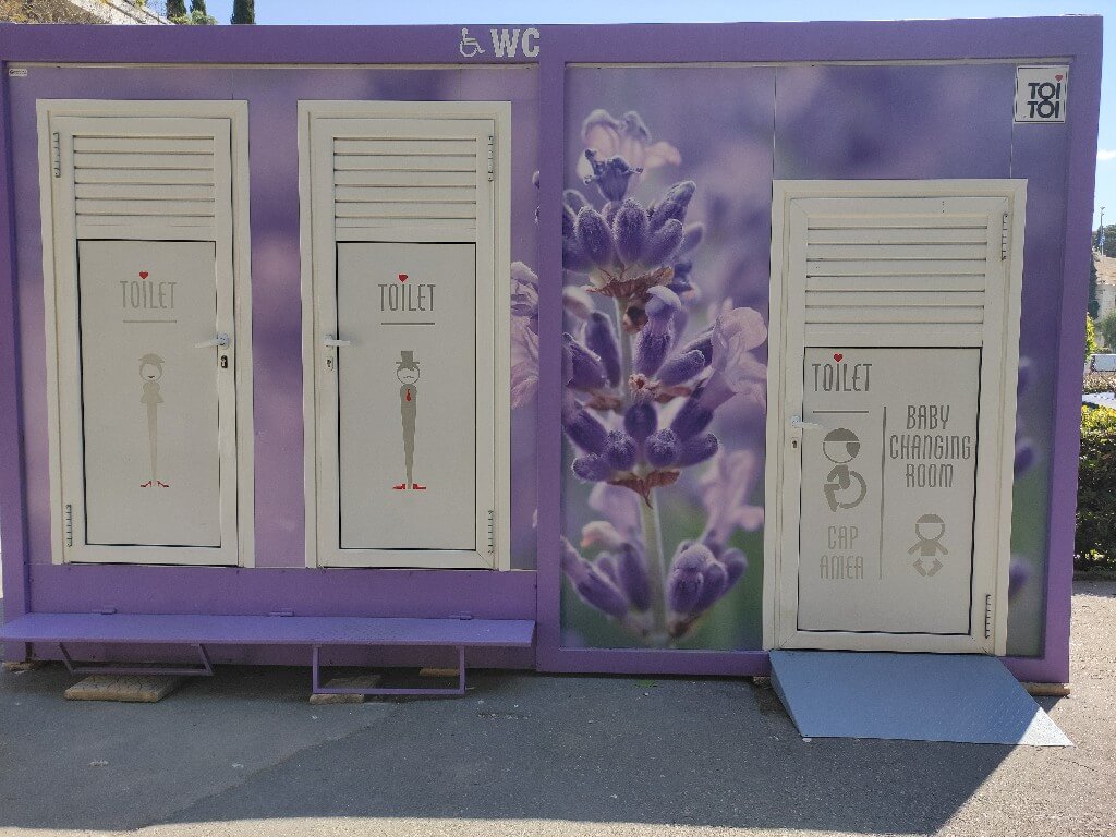
We meet 2 adapted toilets in distinct prefabs. The functional ones are those in purple.
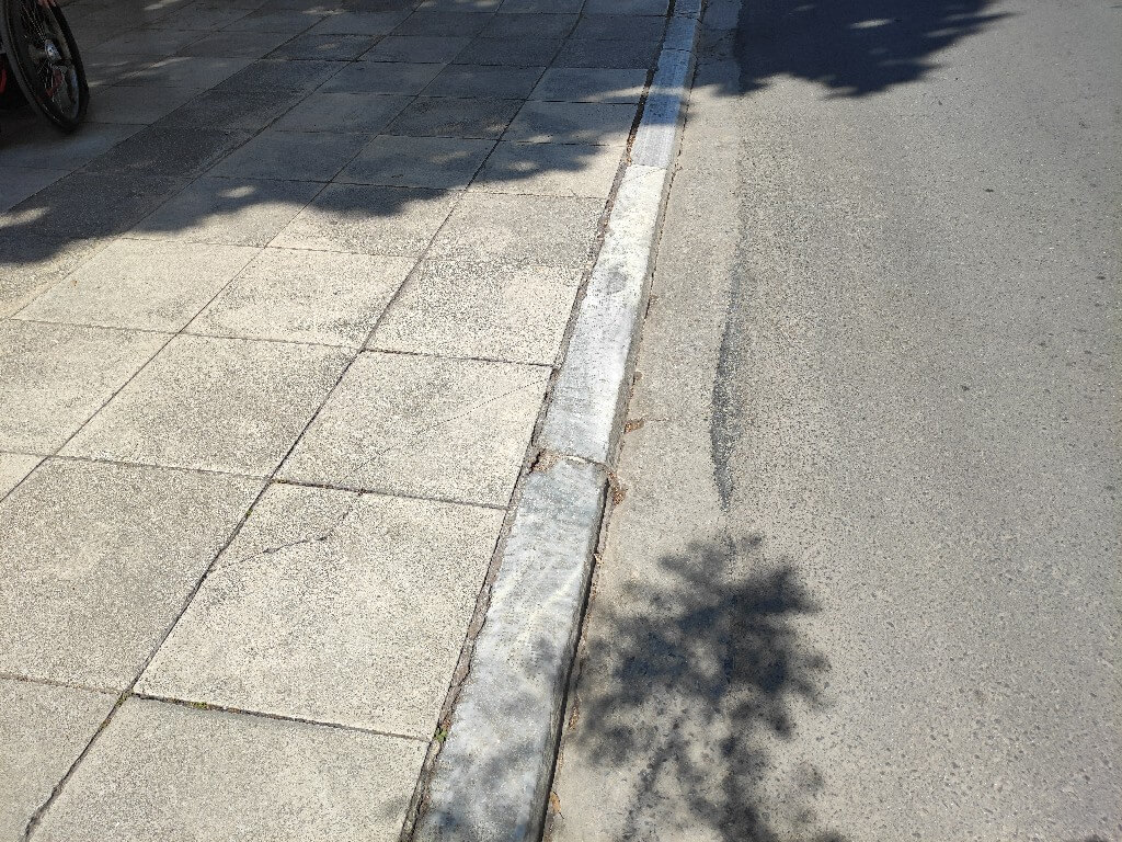
We now have an uninterrupted view of the Panathenaic Stadium, or “Kallimarmaro”, meaning “beautiful marble” in Greek. In this area, there are pedestrian crossings with modern traffic lights that allow unimpeded movement to everyone, so we can safely cross the street to reach the stadium.
Point of interest: Panathenaic Stadium (“Kallimarmaro”)
We return from the same route to reach the junction of Petrou Aravantinou Street and Irodou Attikou Street. From this point we will enter the park.
Attention: On the map you will note some itineraries for various points of interest that appear shorter, but unfortunately these routes are not fordable due to lack of functional ramps.
This specific entrance to the park is paved with asphalt. Entering and continuing a little further on, we will encounter the “Aegli” open air cinema on our left. Disabled people can freely park their vehicles in front of it. Next to the cinema, “Aegli” restaurant is accessible and provides adapted toilets for use.
In case a car is available, this is where it can be parked to enjoy this specific itinerary without the use of the metro. The alternative itinerary is demonstrated below:

Point of interest: Cine “Aegli”
Next to it we find the Zappeion Mansion, with its accessible entrance on the back side.
Point of interest: Zappeion Mansion
At this point, if we want to visit the archaeological site of the “Olympieion”, we must exit the park using the car entrance to “Aegli” and return from there to complete the itinerary step-free.
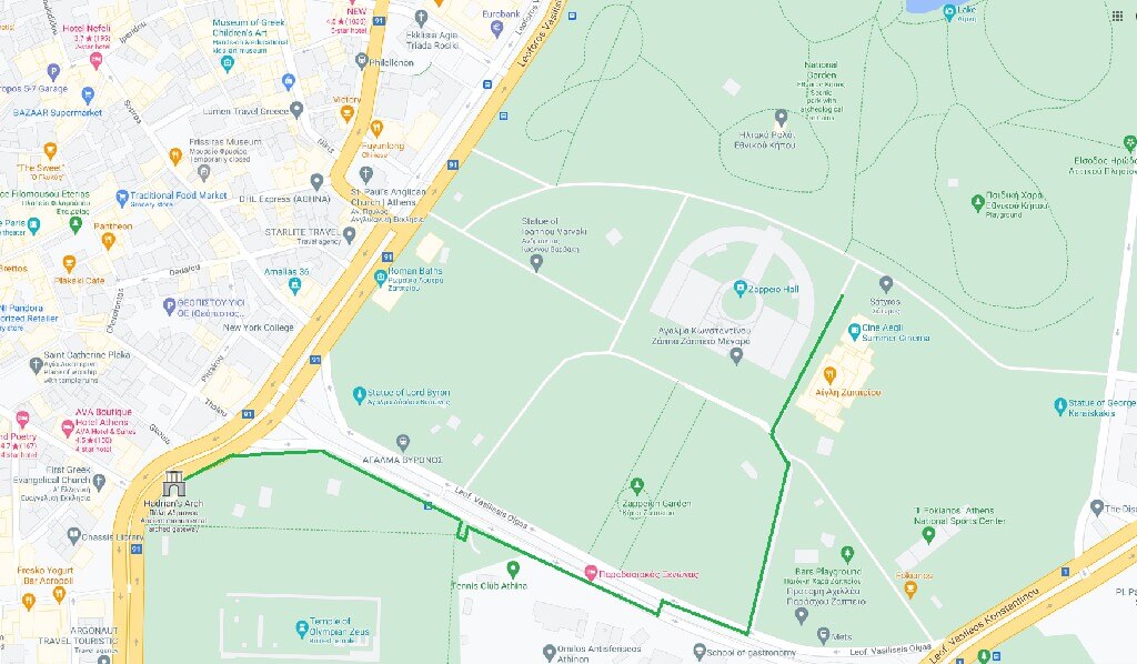
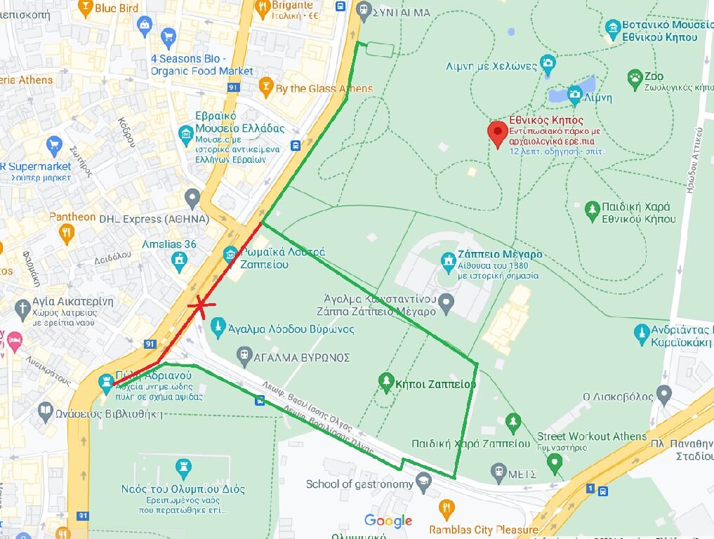
Accessible itinerary from/to Olympieion and Hadrian’s Arch, beginning from Zappeion:
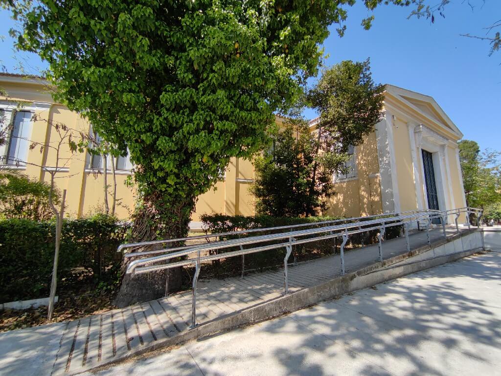
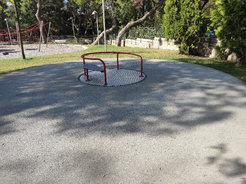
We descend the walkway of the park, having Cine Aegli and “Aegli” restaurant on our left, and Zappeion on our right. A little bit further down the road, we will come to an accessible playground on our left.
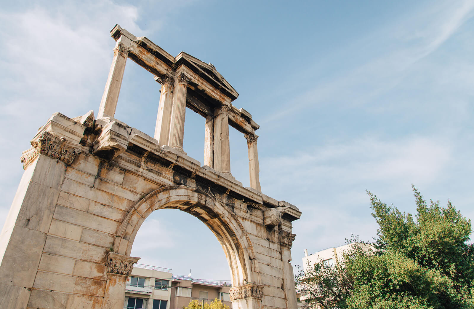
At the end of the street, we will find Vasilissis Olgas Street. On the opposite side of the street, we see the archaeological site of the Olympieion. This avenue features- in order of appearance: a car lane of asphalt for light traffic, a red lane for pedestrians and cyclists, a median strip, another red lane for pedestrians and cyclists, a yellow lane for the tram lines, and another asphalt lane of light traffic. This is part of the “The Great Athens Walk”, where key sections of the street have become pedestrian areas and bicycle lanes to allow for more enjoyable city interactions for pedestrians and cyclists.
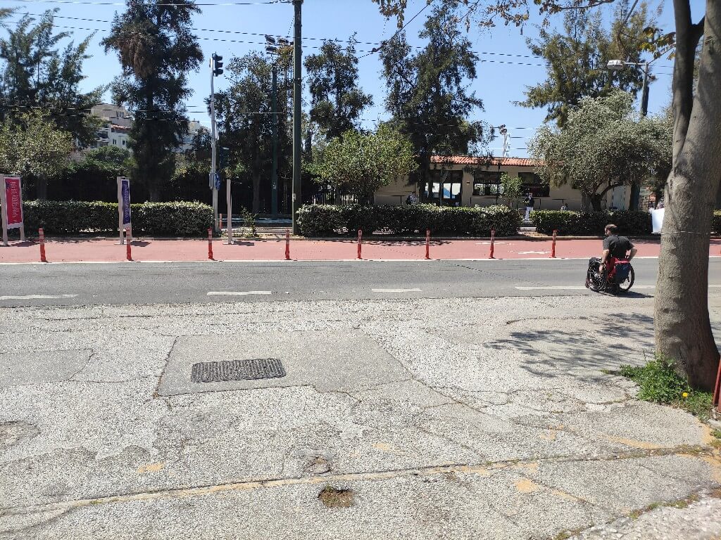
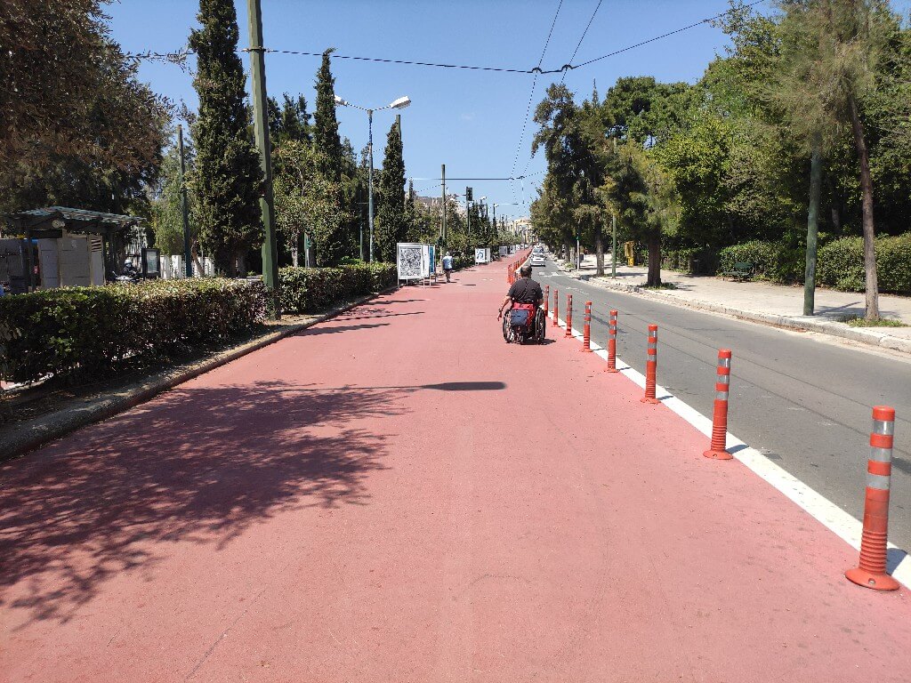
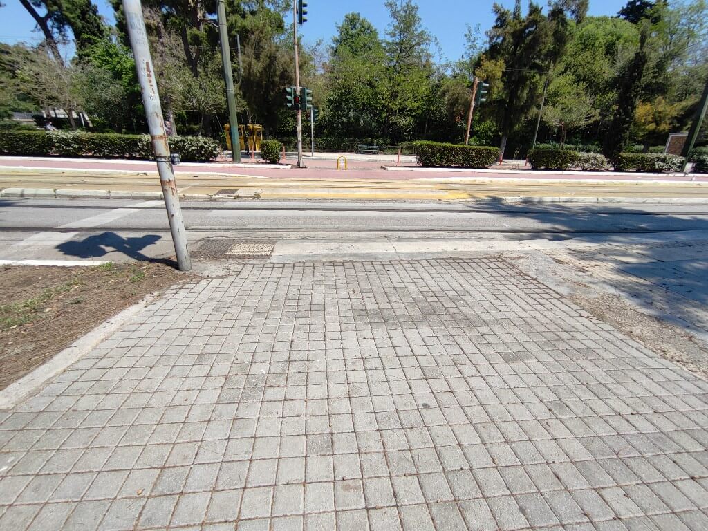
We pass the first lane of the street, reaching the red pedestrian lane and turning to the right to “get on” the street. We are now on an asphalt deemed as a pedestrian area, so it is safe and accessible. In about 60 metres we will find a pedestrian crossing which we will use to reach the opposite pavement. On this pavement we will turn right and ascend 170 metres to find the entrance to the Olympieion.
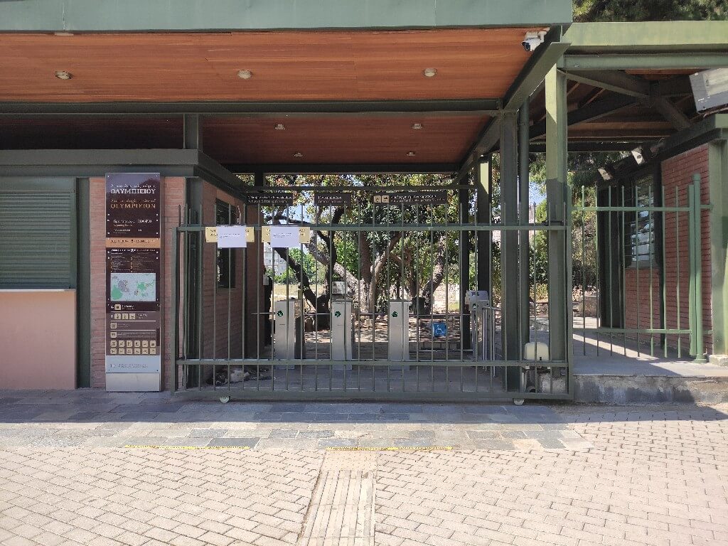
Point of interest: Olympieion-Temple of Olympian Zeus
Return: Similarly, we return to Zappeion to continue the rest of the itinerary step-free. The shortest way is to follow Vasilissis Amalias Avenue from the right pavement following the direction of the cars, to find the main entrance of the park and the Hellenic Parliament. In this case, we must know that at some point there is no ramp and we will have to climb the step of the pavement that has been marked on the map.
The green itinerary is step-free and the red has the aforementioned step.
Our goal is to reach the main entrance of the National Garden, located on Vasilissis Amalias Ave.
Point of interest: National Garden
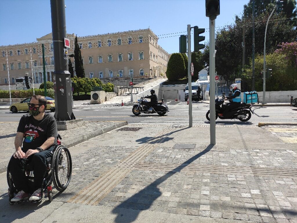
Exiting from the main entrance of the National Garden, on Vasilissis Amalias Avenue, we turn right to reach the Hellenic Parliament.
As we pass the parking entrance, we will find, next to a marble column with a copper shield, the accessible entrance to the Tomb of the Unknown Soldier.
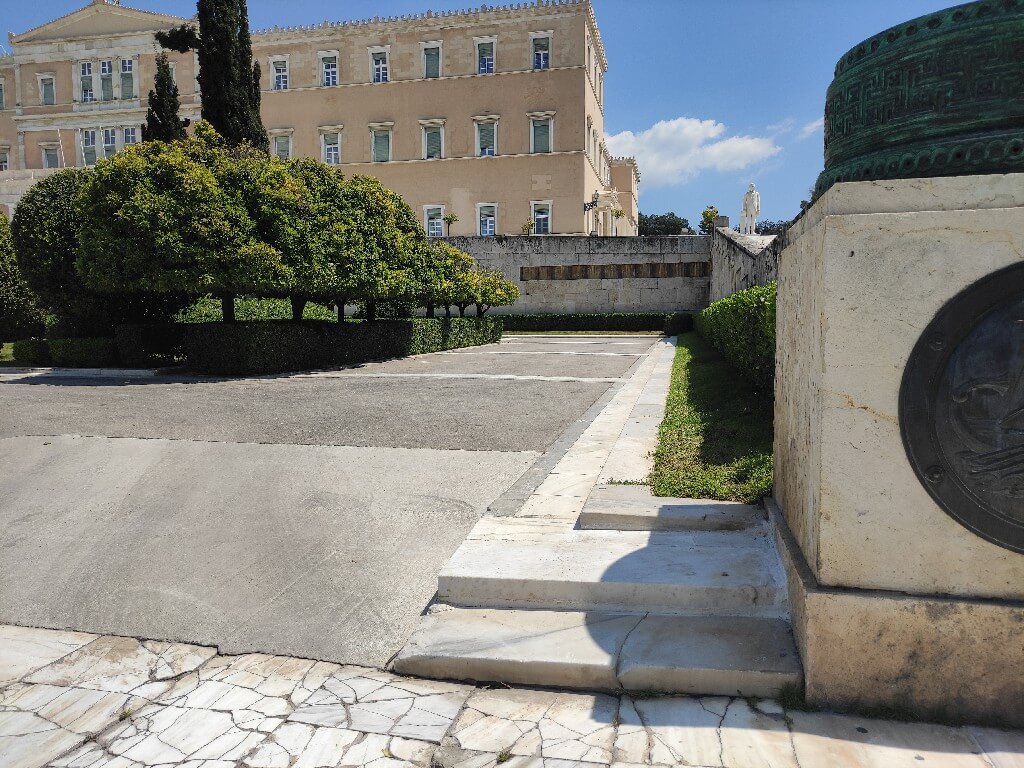
Point of interest: Hellenic Parliament – The Tomb of the Unknown Soldier
To complete the itinerary, we will depart from “Syntagma” metro station. Unfortunately, the elevator is located on Syntagma Square. To use it, we must cross Vasilissis Amalias Ave. via the pedestrian crossing which is next to the parking of the Parliament.
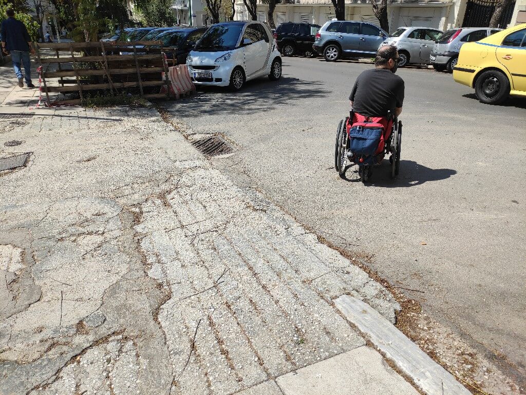
This is where we will find Othonos Street and we will remain on its right pavement, as we descend. At the bottom part of the pavement, we will make a 180∘ turn, enter the square and descend it to reach the elevator of the metro station.
This is where the itinerary ends.
Point of interest: “Syntagma” metro station – Lines 2&3