Man in a wheelchair - Historic Heart to Urban Soul of Athens

Historic Heart to Urban Soul of Athens

Photo: Thomas Gravanis

Historic Heart to Urban Soul of Athens


Photo: Thomas Gravanis

Table of Contents

TGR-AccessibleAthens-1stItinerary-SyntagmaSquare

Itinerary Overview

This itinerary traverses the historic centre of Athens, setting out from the capital’s most emblematic central square: Syntagma Square.

With its key location facing Parliament, Syntagma (Greek for “constitution”) is the beating heart of Athens. Many landmark events, both political and cultural, take place here throughout the year: from the patriotic national parade in March to celebrate Greek Independence, to Athens Pride in June, and the annual lighting of the city’s Christmas tree in December. Fringed with luxury hotels and bustling pavement cafes, Syntagma Square is also your gateway to the most famous shopping street of Athens, Ermou. Ermou dissects the historic centre, and will take you all the way to the hub of Athenian urban culture, Technopolis.

Ermou Street is mostly pedestrianized with flat and easy to navigate paving. The first stretch is packed with global chains and cafeterias. On Ermou, you’ll find the quaint little church of Kapnikarea, one of the oldest in Athens (it was built around 1052). You’re also close to pretty Agia Irini Square, with its flower market and hip hangouts. Ermou Street takes you on to Monastiraki, the centre’s buzziest square, which teems day and night. From this point, the Acropolis comes into glorious view, and you’re positioned near a plethora of world-famous archaeological sites (such as the Ancient Agora and the archaeological site of Keramikos – the cemetery of ancient Athens).

Street stalls, antique shops, tavernas and ethnic food vendors will accompany you until Thissio, where we come across Apostolou Pavlou Street, a lovely walkway that leads to the Acropolis. If we continue on Ermou Street, though, we shall reach the thriving urban neighbourhood of Gazi. Ermou changes character, becoming a more mellow and pedestrian-friendly route. We will encounter the Holocaust Memorial, as well as the archaeological site of Keramikos. At Ermou’s end, the Old Depot hosts some of summer’s most fun-filled festivals. We now find ourselves on Peiraios Street, one of the busiest streets of Athens, linking the city with Piraeus and the port.

By crossing this street, we will arrive in Gazi, an LGBTQI+ friendly area pulsing with nightlife, clubs, bars, and many eclectic eating options. Gazi is also home to the Technopolis of Athens, the city’s former gasworks and these days, a nucleus of contemporary culture. Technopolis is an accessible place to visit, relax and enjoy live concerts, museums and annual festivals (such as the free Technopolis Jazz Festival in May). Our itinerary concludes at Keramikos Square and the “Keramikos” metro station of Line 3 (the blue line).

General Accessibility

  • The itinerary is slightly downhill. According to Google Maps, you will descend 58 metres of altitude overa total distance of 2,5 kilometres. We suggest that you do not attempt the itinerary from the opposite direction, since it is an ascent.
  • The itinerary mostly consists of pedestrian areas with two different pavings: one of medium variation, which was noted as annoying, but not dangerous by wheelchair users (Syntagma – Thissio) and one with flat paving that is totally accessible and safe (Thissio-Gazi).
  • There are no steps in this itinerary.
  • The lighting at night is quite limited, with dark spots here and there.
  • At each point of interest, the accessibility is indicated according to the information available on their website (we have not verified this personally).
  • Most of the shops/cafeterias/bars etc. that we meet along the way are not designed in accordance with accessibility standards and do not provide wheelchair adapted toilets.
  • The itinerary starts from “Syntagma” metro station (line 3, “Airport – Nikaia”). Along the road, we will meet “Monastiraki” station that belongs to both line 3 (the blue one) and line 1 (the green one), as well as “Thissio” station (also line 1). The itinerary ends up at “Keramikos station” of the blue line 3. All of the above stations provide adapted WC, elevators and full access to a wheelchair user. In the blue line, boarding for wheelchair users is done by the first and the last car, where there is no gap. In the green line, boarding is done exclusively using the first door of the first car. Specifically, in “Monastiraki” station, you can ask the station staff for a mobile ramp and assistance, since the gap is quite big.
  • You can begin the itinerary from whichever station you prefer and proceed with the suggested route from there.

Route Description

pre loader
Step 1

Our itinerary begins in “Syntagma” station of the lines 3 “Airport – Nikaia” (blue line) and 2 “Anthoupoli – Elliniko” (red line).


Point of Interest: “Syntagma” Metro Station – Line 2&3


View on the Map
Step 2

From the “Syntagma Square” exit of the metro and the elevator, we cross the Syntagma Square downwards.


Point of Interest: Syntagma Square


View on the Map
Step 3

At the lower part of the square, we will find the Info Point of the Municipality of Athens.


Point of Interest: Tourist Info Point


View on the Map
Step 4

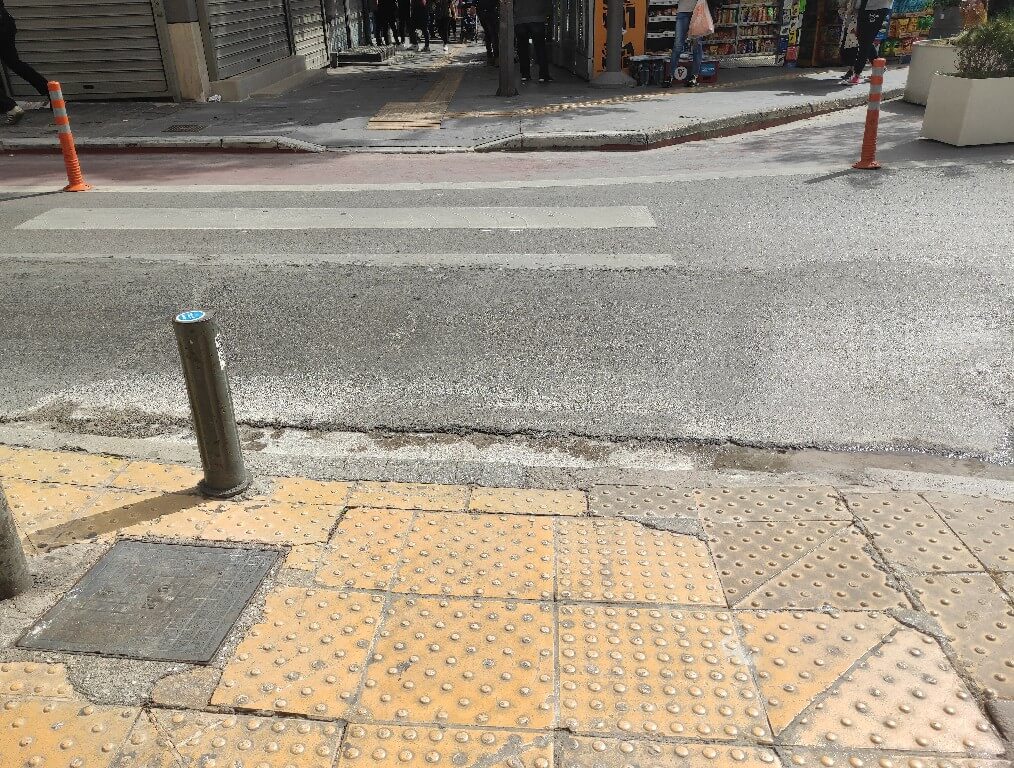
At the lowest part of the square, we find a pedestrian crossing with a ramp. The traffic light offers very little time (15’’) to cross the main street, but it remains red for vehicles for some more time. You don’t have to go up the ramp across the road. It’s preferable to pass directly to the paving of Ermou Street, which is a pedestrianised area.


At the beginning of the street, you can source free, potable water from the public fountain.


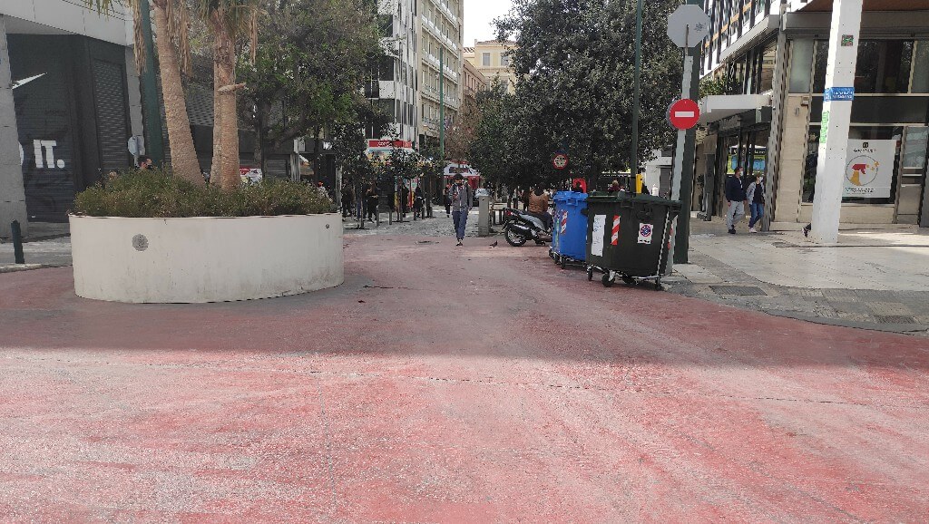
Point of Interest: Ermou Pedestrian Area – Commercial part


View on the Map
Step 5

We descend Ermou Street for 450 metres until the Kapnikarea church.


Point of Interest: Church of Panagia Kapnikarea


View on the Map
Step 6

We continue our descent of Ermou Street and arrive at the end of the pedestrian area, which makes a corner with Aiolou Street.


Point of Interest: Agia Irini Square


View on the Map
Step 7

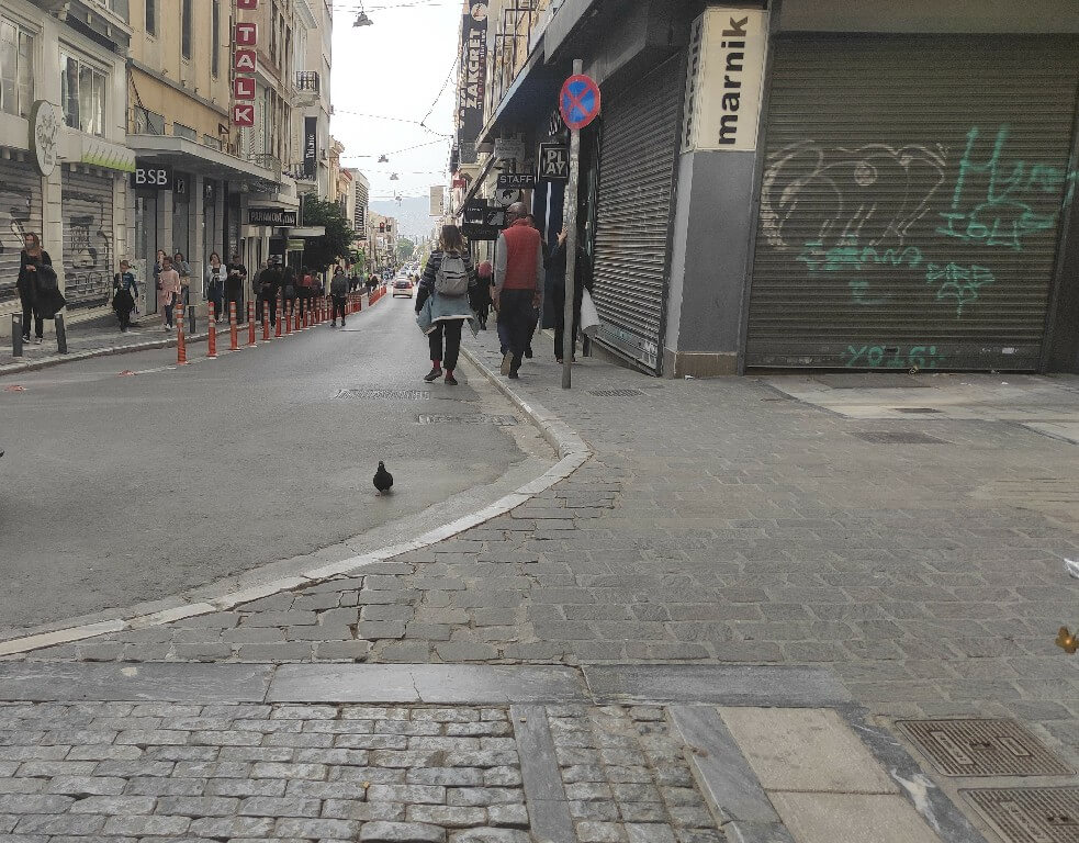
Returning to our initial itinerary, on Ermou Street, you will find that the pedestrian area ends at the junction with Aiolou Street. This is where we will choose the right pavement to continue our descent.

As soon as we get to the junction with the main street, Athinas, we will turn left and cross the traffic light with the pedestrian crossing to reach Monastiraki Square.


We do not proceed in parallel with the street. Instead, we will go straight ahead from the pedestrian crossing to reach the heart of the public square.


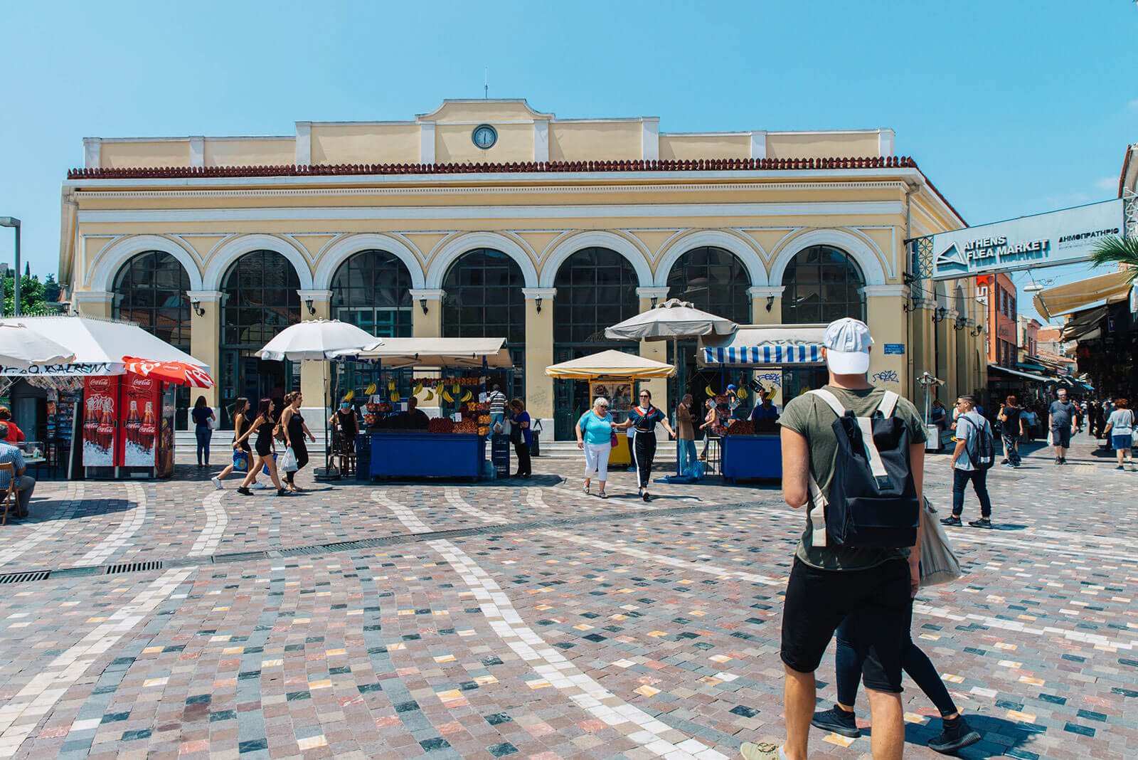
Point of Interest: Monastiraki Square


View on the Map
Step 8

At the end of the square, with the Acropolis looming in the background, you’ll find “Monastiraki” metro station (line 1 & 2)


Point of Interest: “Monastiraki” Metro Station – Line 1&3


View on the Map
Step 9

Turning to the right of the station, we will discover the busy Hephaestus Street: the oldest open-air market in Athens. Flea Market Monastery.


Point of Interest: Flea Market


View on the Map
Step 10

Our tour continues from “Monastiraki” station. Taking the street at the left of the station, Areos Street (a slightly upward street 50-metres long), we come to Hadrian’s Library.


Point of Interest: Hadrian’s Library


View on the Map
Step 11

From Hadrian’s Library, Adrianou Street begins. This is a very well-known pedestrian area with fordable paving that stretches for 500 metres, leading to Thissio. To the left, we’ll see the archaeological site of the Ancient Agora and the tracks of line 1 of the metro; while to the right, there are numerous restaurants, cafes and bars with outdoor pavement tables. Their interiors do not usually meet accessibility prerequisites.


Point of Interest: Stoa of Attalos & Ancient Agora


View on the Map
Step 12

Adrianou Street ends and we have arrived in Thissio. The Agiou Pavlou pavement area begins to our left. If we ascend it, we will find ourselves at the foothills of Acropolis (you can explore this legendary part of Athens with one of our other accessible itineraries “Ancient Athens uncovered”). Straight ahead lies the “Thissio” metro station.


Point of Interest: “Thissio” Metro Station – Line 1


View on the Map
Step 13

To the right of the station our itinerary continues and we are reunited with Ermou Street, which has now turned into a pedestrian area anew. The paving is no longer annoying for the wheelchairs, while the slight downward incline makes this part of Ermou perfect for strolling (it’s 550 metres long).


At 150 metres from the beginning of the pedestrian area, we find the Holocaust Memorial to our right.


Point of Interest: The Holocaust Memorial in Athens


View on the Map
Step 14

After a200-metre distance from the Memorial, we encounter the archaeological site of Keramikos. It is situated lower than the level of Ermou Street. and is surrounded by railings that permit a full view of the ancient site.


Point of Interest: Archaeological Site of Keramikos


View on the Map
Step 15

After 200 metres, Ermou Street ends. This is where we find the old depot of the O.S.Y. (Road Transportation)


Point of Interest: The Old Depot


View on the Map
Step 16.1

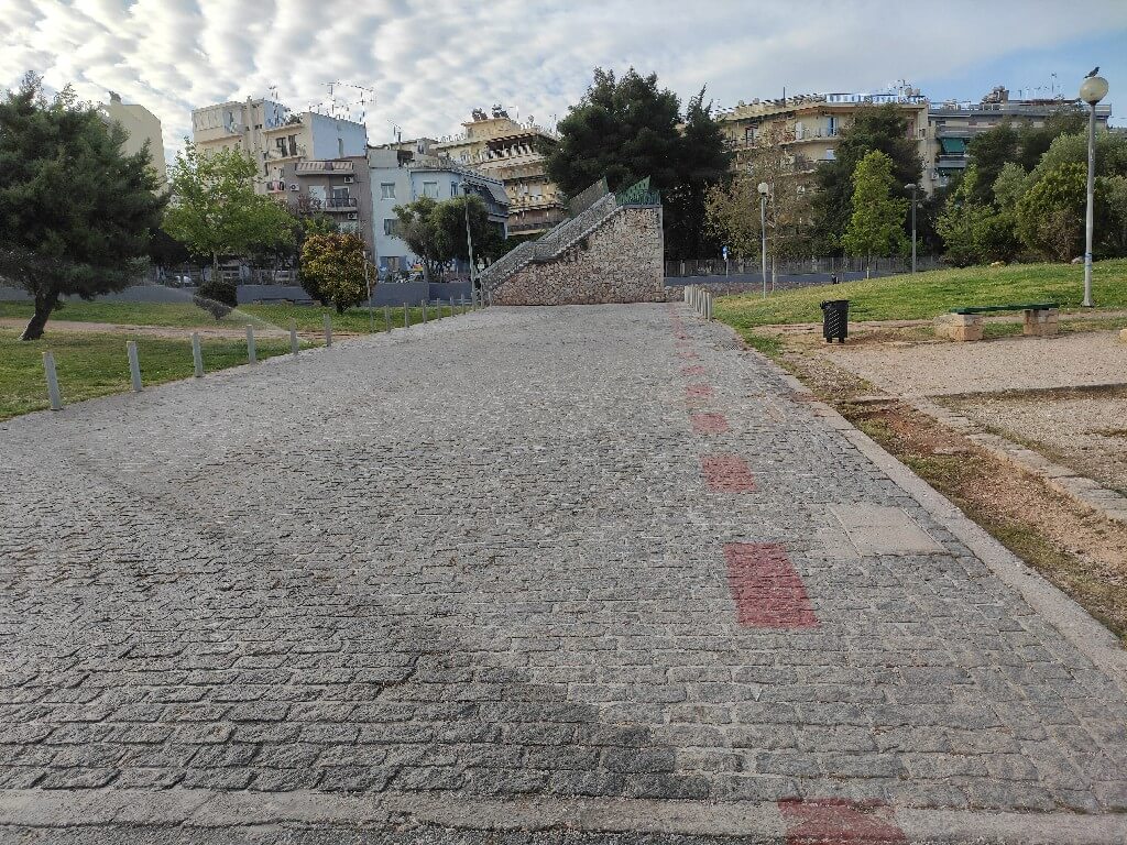
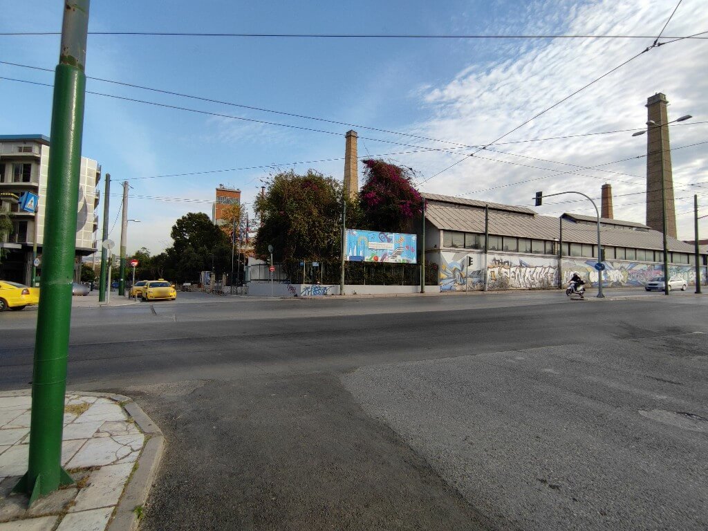
Once Ermou becomes a street again, the Technopolis appears opposite us – our next landmark to visit. Unfortunately, there are no ramps to execute the itinerary in a conventional and safe way. For that reason, we turn left (in the opposite direction of Technopolis) and we ascend towards the metro tracks and the stonewall. This pedestrian area is called Dimofontos, it is 50 metres long with an upsweep of 2 metres, so it is slightly upward. At its end, we find the Thessalonikis pedestrian area and we turn right. A shallow paving is set here.


For 130 metres, we proceed slightly downwards. We find Persefonis Street in front of us and we cross it via the pedestrian crossing.


When we reach the opposite pavement, we do not get onto it, but we carefully continue in parallel with the pedestrian area, in the red cycle lane, following the direction of the cars, until we arrive at the junction of Persefonis and Piraeus Street.


View on the Map
Step 16.2

We cross Piraeus Street and proceed to the opposite side, while staying on Persefonis Street. Again, we do not get onto the pavement, but instead we head to the right pavement of the street to access the entrance of Technopolis.


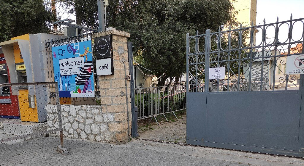
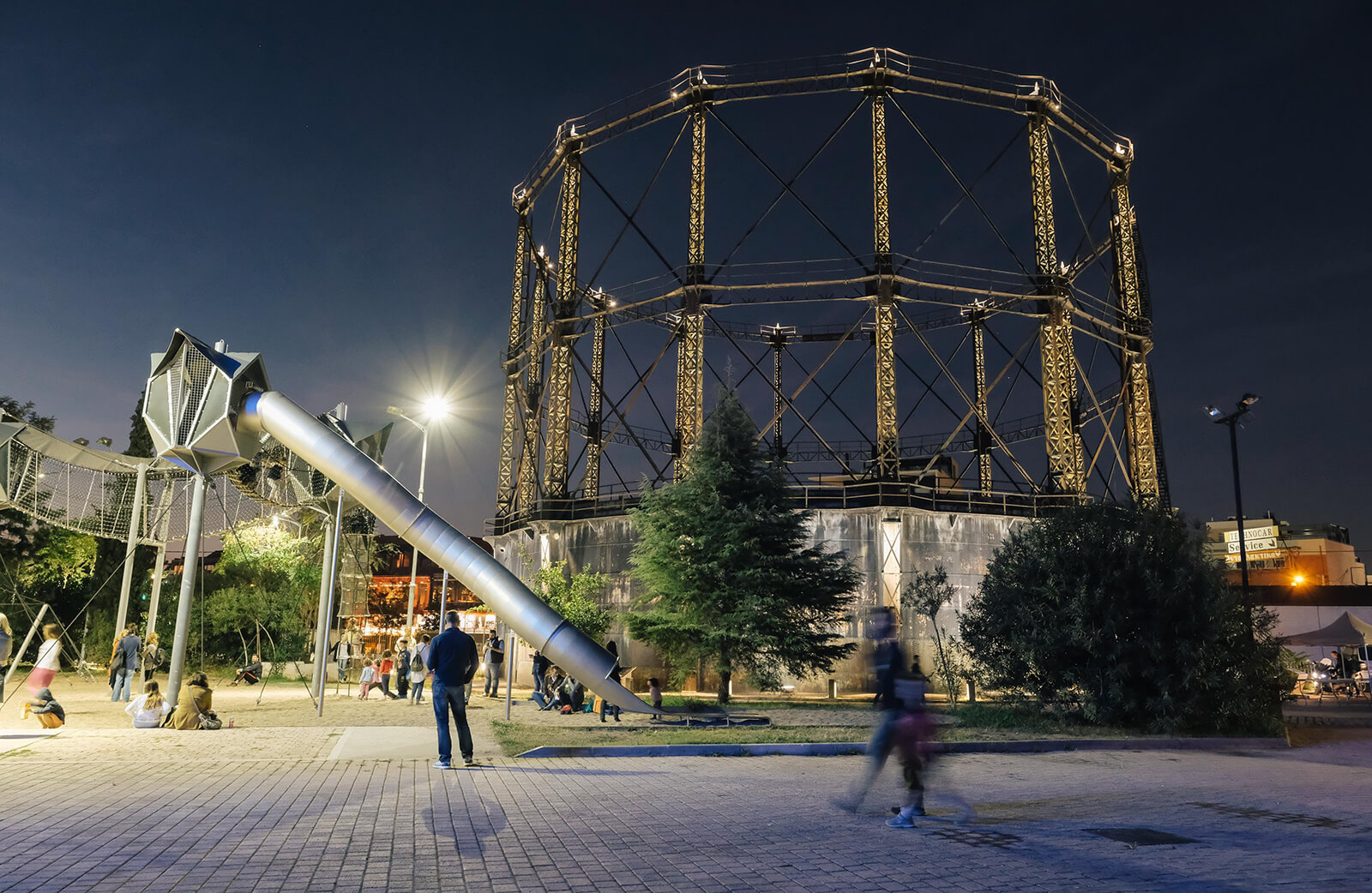
Point of Interest: Technopolis City of Athens


View on the Map
Step 17.1

We continue our itinerary outside Technopolis and we keep heading down until the metro station. We can do that either by travelling alongthe street of light traffic, which is only a 180-metre distance until the station, or taking the pavement.

The pavement:

i) It has ramps. The first that we meet is slippery, steep and 8 cm high.


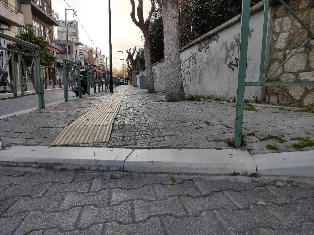
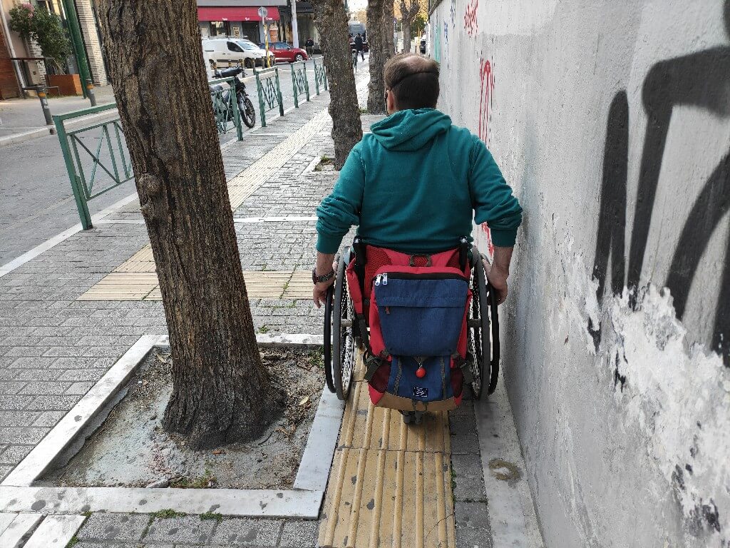
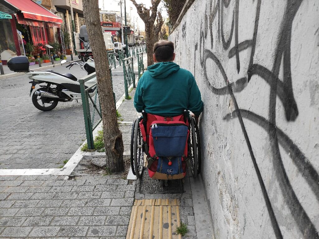
ii) In 2 spots there is a narrow passage between the tree trunks and the wall. The first one is 80 cm wide, the second is 75 cm from the pavement, but technically it has a 1-metre width.


View on the Map
Step 17.2

Point of Interest: “Keramikos” Metro Station – Line 3


View on the Map
Route End

Point of Interest: Gazi


View on the Map

Map

Ancient Athens Uncovered